Let's Talk About Charts
We are very spoiled when cruising in the Canadian and US waters. The charts are detailed and fairly accurate. Also, from what I see on my charts Bahamas, USVI and BVI are the same, which I can't confirm as we haven't been there yet. The problem with Cuban and Mexican charts is that they are either sporadic at best or sometimes almost downright non existent. Some people would say I'm crazy not to carry paper charts. But my thinking is the electronic charts are updated regularly, and your paper charts can be out of date within days of purchase. To stay current, you would have to get the information off the website and manually update your charts. Now don't get me wrong, I'm not bashing paper charts and I love to use them as they give you a great overview, but why would I go to the trouble of updating paper charts when it is done automatically by your electronic chart supplier. I have an older Lowrance with 10 year old Navionic charts, a new Garmin in the cockpit, the new Garmin Bluechart Mobile App with Active Captain on my IPad, Sea Charts on my computer and last, a portable Garmin. I have looked at all of them and found them all the same. The chart plotters can only give you the information that is available to them.
So, where am I going with this? Since traveling the Cuban and Mexican waters I have found it difficult to get detailed and accurate charts. Overall, Cuba's charts are minimal as soon as you leave a major port. Mexico is somewhat better in highly traveled areas, but go outside the beaten path, then they are minimalistic also.


So, where am I going with this? Since traveling the Cuban and Mexican waters I have found it difficult to get detailed and accurate charts. Overall, Cuba's charts are minimal as soon as you leave a major port. Mexico is somewhat better in highly traveled areas, but go outside the beaten path, then they are minimalistic also.
Detailed Garmin, Havana Cuba Habour Open To Commercial Vessels Only
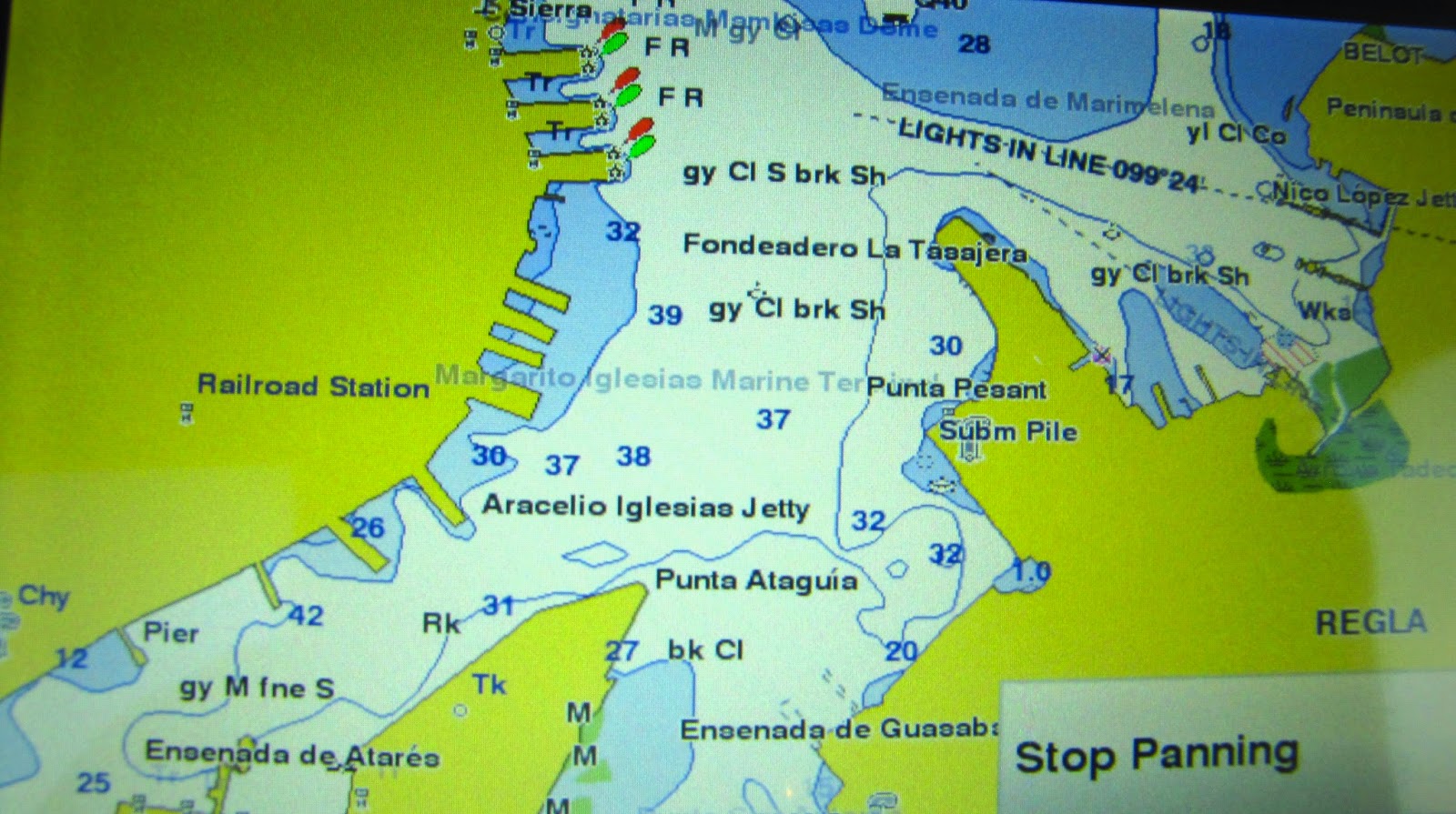
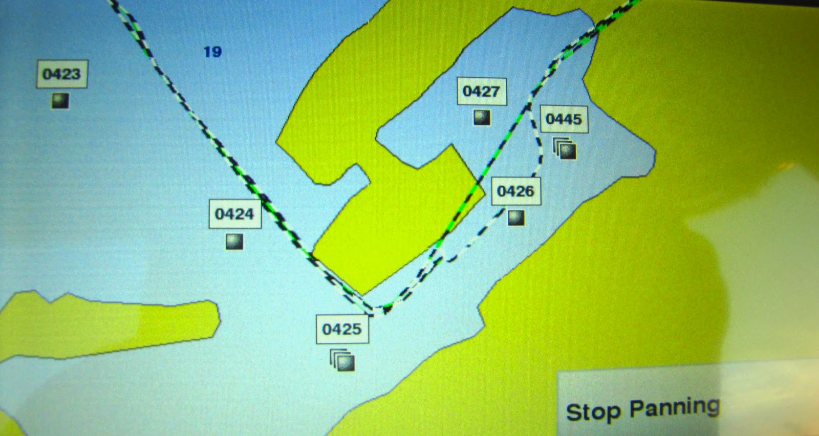
Garmin Chart Of Hemingway Marina. A Large Pleasure Craft Marina Near Havana. As You Can See, There Is No Detail.
(The Markers 423 To 427 Were Part Of My Plotted Course).
This View Of Hemmingway Marina, Same As Above Is Information Of Provided By The Cruising Guide To Cuba By Cheryl Barr
Detailed And Clear To Understand
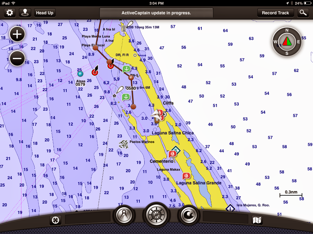
Garmin Overview Of Highly Cruised Isla Mujeres Mexico
Garmin Zoomed In Chart Of Isla Mujeres Mexico

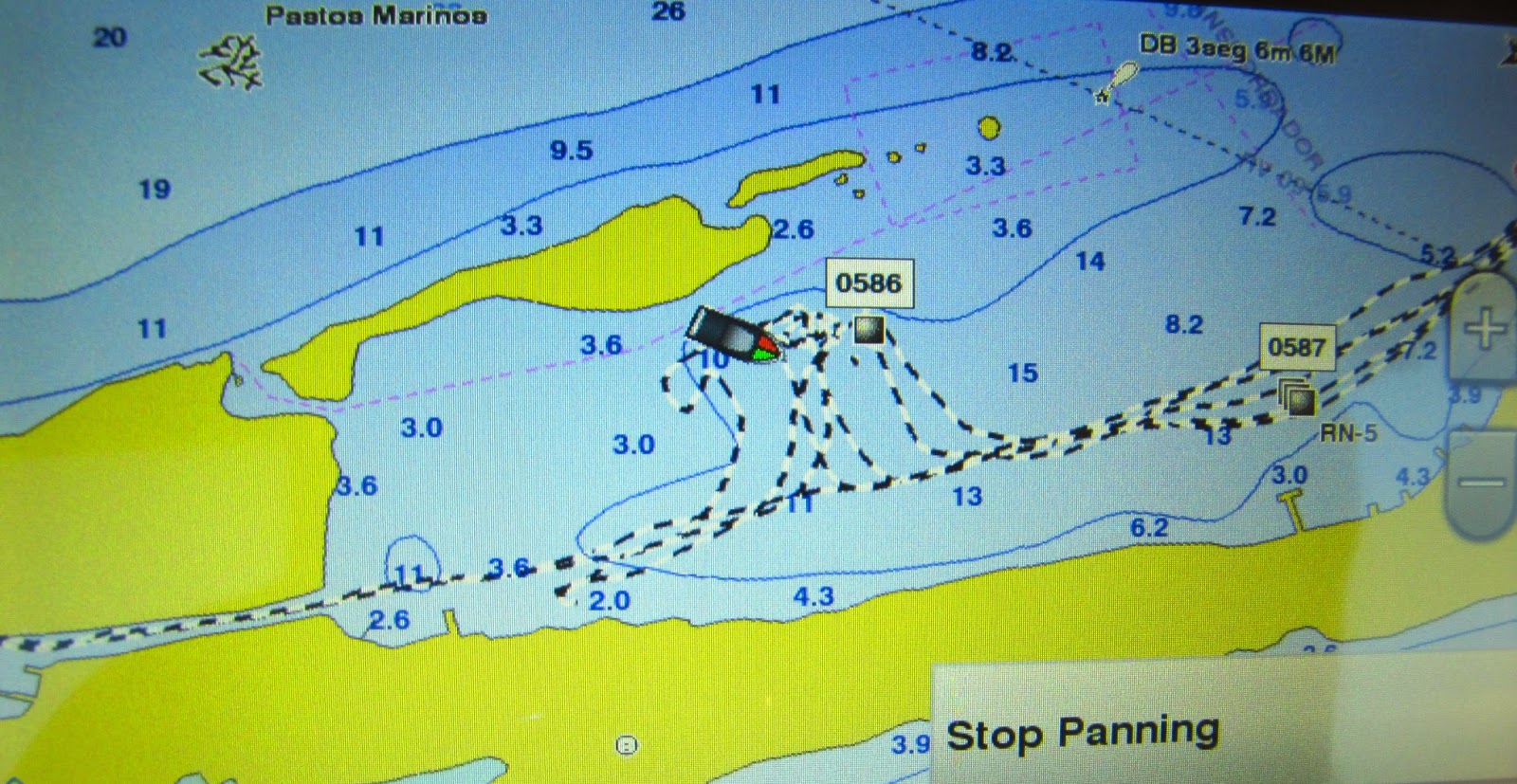
Isla Contoy Is Only 15 Nm From Isla Mujeres. This Island Is 4.5 Miles Long And Limited Detail With The Garmin Chartplotter. The Dotted Line You See Was The Course We Took. As You Can See At One Point We Were Doing Some Cross Country Travelling With Our Sailing Vessel Devocean.

Although, This Cruising Guide To Mexico Is Seven Years Old, We Found The Detailed Charts In It, More Valuable Than Our Inaccurate Electronics
One quick word about Active Captain. This is probably my favourite navigational tool, on board. If you have an IPad with a GPS, you can purchase the Garmin Bluecharts Mobile App and charts. Then join Active Captain for free. Active Captain is an information gathering system that interacts with the Garmin Mobile Chart. This is updated by cruising members, giving you current information on anchorages, marinas, hazards, fuel prices and more. I would highly recommend the Garmin Bluechart Mobile App with Active Captain to anyone. Best purchase we have done yet.
Garmin Bluechart Mobile App With The Active Captain Gives You Icons To Achorages, Marinas And More. By Touching The Icons You Get Actual Information Supplied By Cruisers. Well Worth The Money.
My recommendations:
When sailing these waters get the most accurate recent Cruising Guide books you can find. They are a great source of information.
When sailing these waters get the most accurate recent Cruising Guide books you can find. They are a great source of information.
Never enter an unknown location in the dark unless it's an emergency.
When in doubt, sail the deeper water as much as possible.
Don't get complaisant in deep water.
Not all shoals or reefs are marked.
The best indicator for shallow water is color, but even the colors can be affected by cloud shadows and you need to keep a sharp eyeball.
Finaly, I would like to say i'm not anti paper chart, pro electronic charts or pro guides. This is what has worked for us so far.
May the trade winds be with you.
Finaly, I would like to say i'm not anti paper chart, pro electronic charts or pro guides. This is what has worked for us so far.
May the trade winds be with you.
The only opinion that matters is yours and your crews. It really doesn't
ReplyDeletematter what anyone else thinks.
This chart discussion is like many others in boating having to do with risk
management and your personal comfort with ambiguity. Risk is the balance
between "impact" and "probability." If the probability is low, but the
impact is high... Who was it that said, "good judgement comes from
experience; experience comes from bad judgement."
Fall, 2013, Sanctuary and crew ran from the Chesapeake (Baltimore) to
Florida (Charlotte Harbor) without having paper charts at the ready, as a
test case. We used an iPad running SEAiq USA (much, much better than
Garmin BlueChart Mobile) and Coastal Explorer. We got realtime nav data
from our flybridge instruments via a wi-fi multiplexer, not via our iPad's
built-in GPS chip. Even though we are fairly familiar with the ICW, I
still found times when I missed having notes I had previously written on my
paper charts. Because of past experience and our limited "local
knowledge," it worked out for us. Not at all sure I would have liked it in
waters where we had less prior familiar. I remember one year we went
outside at Doboy Sound, headed North. When we got outside, we encountered
four foot rollers abeam from the SE, so we decided to come back in at
Sapelo Sound. (Dumb, I know; calm inside, but lumpy outside. Bad
judgement!) Anyway, there are large blind pockets in the shoals on that
shelf that you can run far into if you don't look far enough ahead; i.e.,
many miles ahead. If you do that, you'll have to backtrack many miles to
clear those shoals and get around them. There's a reason that area is
called, "the graveyard of the Atlantic." Not at all sure the iPad would
have alerted us to that. Maybe; just can't know. After all, one of the
four quadrants of knowledge is, "don't know what we don't know."
In the Bahamas, I recommend Sarah and Monte Lewis' "Explorer Charts."
Paper or electronic; I think I prefer paper, but Garmin and other Chart
Plotters license the Explorer chartkit's data and do have them built in.
Not sure if they're available as RNCs or ENCs for the iPad.
Hope these ramblings make some sense.
Jim
I am big paper chart fan because we could never afford the electronic stuff and I always hear in my head "if it can go wrong it will go wrong" But am with you all the way as far as they are out of date very quickly and things can change in a blink after hurricanes (water depths and missing buoys etc)so we always believe that nothing beats looking for yourself double check everything and never take anything for granted.Sounds as though you have your head screwed on the right way Marc.Love reading the blog
ReplyDeleteEllinor Leonard